About the Park
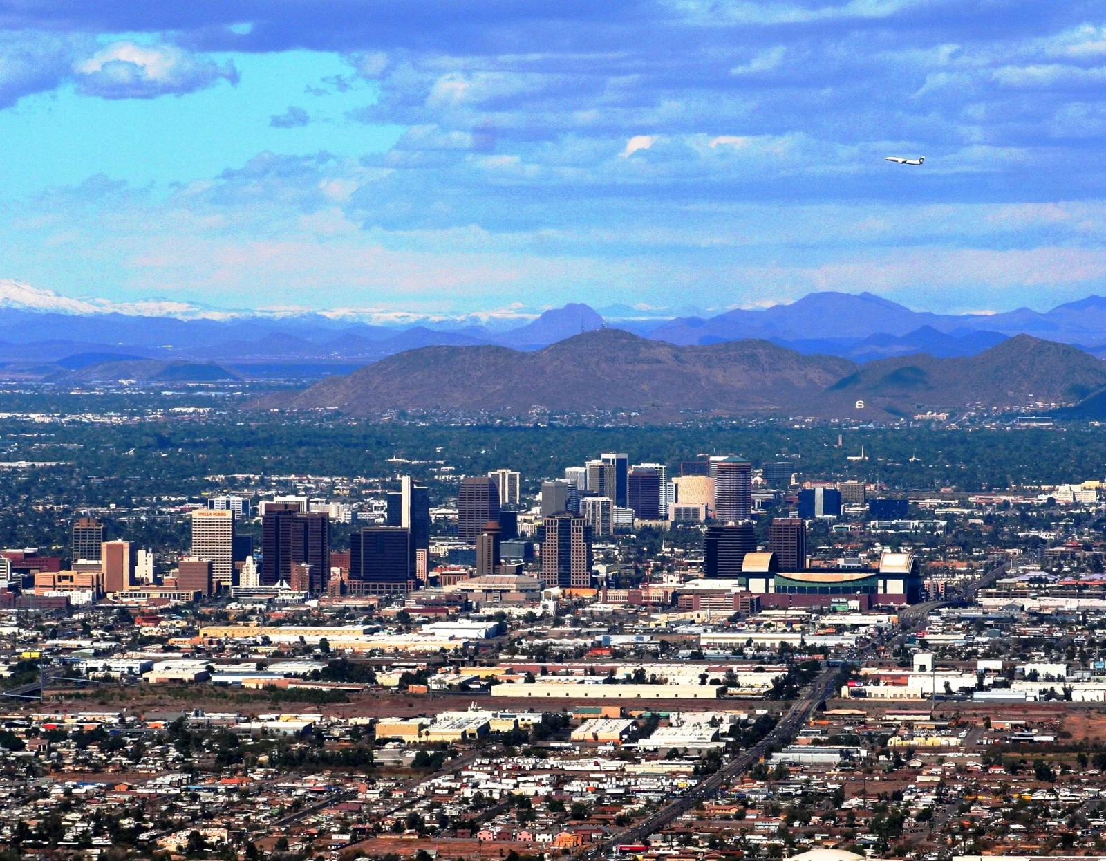
South Mountain Park and Preserve is a City of Phoenix park of more than 16,000 acres in Phoenix, Arizona, and one of the largest municipally managed parks in the United States. It covers three mountain ranges, the Ma Ha Tauk, the Gila and the Guadalupe, with more than 100 miles of trails. The City bought the first 13,000 acres in 1924 for $17,000 and marked 100 years of stewardship in 2024. Its highest public point is Dobbins Lookout, at 2,330 feet.
South Mountain at a Glance
Who Runs South Mountain
The park is run by the City of Phoenix Parks and Recreation Department, through its Natural Resources Division and park rangers. It is a city park, not a state or national park. Phoenix's rangers look after more than 41,000 acres of desert parks and mountain preserves citywide, from trail patrol to trail building and safety education. The City's map notes that the preserve is protected by the City Charter, and that travel off the designated trails is prohibited.
Three Mountain Ranges
The City describes South Mountain as three ranges in one park:
- Ma Ha Tauk Range — the City's trail guide places the Alta Trail on its crest, and the Ma Ha Tauk Trail and the Ma-Ha-Tuak Perimeter Trail are named for it (the City spells it both ways).
- Gila Range — the Gila Trail on the City's map is 5.3 miles.
- Guadalupe Range — the Guadalupe Perimeter Trail on the map is 7.2 miles.
The National Trail runs 15.4 miles along the spine of the park.
History
Before the City: the Hohokam
South Mountain holds thousands of petroglyphs, most left by the Hohokam, who lived in central and southern Arizona from about AD 450 to 1450. The City's archaeology guide says they probably did not live in the mountains but came here to hunt, gather, tend gardens and hold ceremonies, and that the mountains were probably sacred to them, as they are to local tribal communities today. The City's trail map includes a land acknowledgement recognizing that Phoenix lies within the homeland of the O'Odham and Piipaash peoples and their ancestors. Petroglyphs
1924: the Purchase
In 1924 the City of Phoenix bought 13,000 acres of the mountains for $17,000. The park has since grown past 16,000 acres.
The 1930s: the Civilian Conservation Corps
Several of the park's older trails and structures date to the 1930s. The City credits the Alta Trail's big switchbacks to inmate labor and Civilian Conservation Corps crews, and the Kiwanis Trail passes two CCC rock wall dams (Kiwanis Trail).
2024: the Centennial
On November 8, 2024, the City celebrated 100 years of stewardship at the newly renovated South Mountain Visitor Center, formerly the South Mountain Environmental Education Center. A centennial time capsule now sits inside an interior wall of the Visitor Center (Visitor Center).
2026: the Activity Complex
The remodeled South Mountain Activity Complex, at 10401 S. Central Ave., held its grand opening on April 2, 2026. On the fourth Sunday of each month it is where cars park while Summit Road is closed (Silent Sunday).
What People Come For
- The view from Dobbins Lookout, by car or on foot.
- Hiking on more than 100 miles of trail, from paved loops to hard climbs.
- Mountain biking and road cycling on the park roads.
- Horseback riding on the trail system.
- Petroglyphs along several trails.
- Picnics at the park's ramadas (Plan Your Visit).
About the Park FAQ
How big is South Mountain Park?
More than 16,000 acres, according to the City of Phoenix, which calls it one of the largest municipally managed parks in the nation.
Who owns South Mountain Park and Preserve?
The City of Phoenix. It is run by the Phoenix Parks and Recreation Department, not by the state or the National Park Service.
When did South Mountain Park open?
The City of Phoenix bought the original 13,000 acres in 1924 for $17,000, and celebrated the park's 100th anniversary in 2024.
What mountain ranges are in South Mountain Park?
Three: the Ma Ha Tauk, the Gila and the Guadalupe.
What is the highest point of South Mountain you can visit?
Dobbins Lookout, at 2,330 feet, is the highest point open to the public.